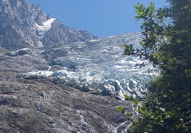
Trail  Les Houches - tour-du-mont-blanc - Photo
© OpenStreetMap contributors
Length
Length
166 km
Max alt
Max alt
2537 m
Uphill gradient
Uphill gradient
10578 m
Km-Effort
Km-Effort  
307 km
Min alt
Min alt
975 m
Downhill gradient
Downhill gradient
10578 m
Boucle
Boucle
Yes
Creation date :
2022-08-31 14:50:31.533
Updated on :
2022-08-31 14:50:31.533

(0 Reviews)


Scan this QR Code to open this trail in the SityTrail application

FREE GPS app for hiking

Logo SityTrail SityTrail

IGN / Geographical institutes

Download SityTrail from the App Store Download SityTrail from Google Play

Logo SityTrail SityTrail World

The world is yours!

Download SityTrail from the App Store Download SityTrail from Google Play Download SityTrail on Huawei AppGallery

About

Trail of 166 km to be discovered at Auvergne-Rhône-Alpes, Upper Savoy, Les Houches. This trail is proposed by zefreefly.

Description

Le Tour du Mont-Blanc (TMB) est l'un des plus beaux treks d'Europe. Il offre des paysages d'une beauté exceptionnelle au travers des 3 pays traversés, la France, l'Italie et la Suisse.
Le parcours sur des sentiers balisés emprunte des vallées et cols alpins avec des panoramas majestueux : cascades, chalets d'alpage, lacs, aiguilles et glaciers de haute montagne.
Nul besoin d'être un alpiniste chevronné, le TMB est accessible aux bons "randonneurs de plaine" ayant l'habitude de marcher avec un sac à dos plusieurs jours de suite.
Ce topo présente une itinérance de 9 jours réalisée en septembre 2017. Le départ s'est effectué aux Houches dans le sens anti horaire. Les refuges ont été réservés à l'avance pour avoir un hébergement et aussi pour calibrer les distances et dénivelés journaliers du parcours.

Description du parcours :

- jour1 : Les Houches - Nant Borrant
- jour2 : Nant-Borrant - Refuge de la Nova
- jour3 : Refuge de la Nova - Refuge Combal
- jour4 : Refuge Combal - Refuge de Bertone
- jour5 : Refuge de Bertone - Ferret
- jour6 : Ferret - Champex d'en Haut
- jour7 : Champex d'en Haut - Refuge du Tour
- jour8 : Refuge du Tour - le lac Blanc - la Flégère
- jour9 : La Flégère - le Brévent - les Houches.

Centrale de réservation : [url]https://www.montourdumontblanc.com/fr/index.aspx[/url]

Elevation profile

Points of interest

Point of interest Chamonix-Mont-Blanc - le Brévent Telecabine - Photo
zefreefly
CHAMONIX-MONT-BLANC 
Point of interest Chamonix-Mont-Blanc - Col du Brévent - Photo
zefreefly
CHAMONIX-MONT-BLANC 
Point of interest Chamonix-Mont-Blanc - Refuge de la Flégère - Photo
zefreefly
CHAMONIX-MONT-BLANC 
Point of interest Chamonix-Mont-Blanc - Le Lac Blanc - Photo
zefreefly
CHAMONIX-MONT-BLANC 
Point of interest Chamonix-Mont-Blanc - Refuge du Tour - Photo
zefreefly
CHAMONIX-MONT-BLANC 
Point of interest Chamonix-Mont-Blanc - Col de Balme - Photo
zefreefly
CHAMONIX-MONT-BLANC 
Point of interest Trient - Col de la Forclaz - Photo
zefreefly
Point of interest Martigny-Combe - Col de Portalo - Photo
zefreefly
MARTIGNY-COMBE 
Point of interest Orsières - Champex d'en Haut - Photo
zefreefly
Point of interest Orsières - Refuge du Ferret - Photo
zefreefly
ORSIÈRES 
Point of interest Orsières - Col du Grand Ferret - Photo
zefreefly
Point of interest Courmayeur - Refuge de Bertone - Photo
zefreefly
COURMAYEUR 
Point of interest Courmayeur - Courmayeur - Photo
zefreefly
COURMAYEUR 
Point of interest Courmayeur - Refuge de Combal - Photo
zefreefly
COURMAYEUR 
Point of interest Les Contamines-Montjoie - Col du Bohomme - Photo
zefreefly
LES CONTAMINES-MONTJOIE 
Point of interest Saint-Gervais-les-Bains - Col de Tricot - Photo
zefreefly
SAINT-GERVAIS-LES-BAINS 
Point of interest Courmayeur - Col de la Seigne - Photo
zefreefly
COURMAYEUR 
Point of interest Bourg-Saint-Maurice - Refuge de la Nova  - Photo
zefreefly
BOURG-SAINT-MAURICE 
Point of interest Les Contamines-Montjoie - Nant Borrant - Photo
zefreefly
LES CONTAMINES-MONTJOIE 
Point of interest Les Houches - Les Houches - Photo
zefreefly
LES HOUCHES 

Positioning

Country:
France
Region :
Auvergne-Rhône-Alpes
Department/Province :
Upper Savoy
Municipality :
Les Houches
Location:
Unknown
Start:(UTM)
329105 ; 5084241 (32T) N.

Trails nearby

Trail Walking Chamonix-Mont-Blanc - J8 - Cascade du Dard - Photo
Walking

Walking

Medium
(1)
Chamonix-Mont-Blanc, Auvergne-Rhône-Alpes, Upper Savoy, France
6.1 km | 9.4 km-effort
1h 45min
Yes
Trail Walking Les Houches - J4 - Les Chavants - Charousse - Vaudagne  - Photo
Walking

Walking

Medium
(1)
Les Houches, Auvergne-Rhône-Alpes, Upper Savoy, France
7.3 km | 11.4 km-effort
2h 10min
Yes
Trail Walking Les Houches - 2024-05-29_17h11m02_christ-roi - Photo
Walking
GUIDE
mumu.larandonneuse

Walking

Easy
(1)
Les Houches, Auvergne-Rhône-Alpes, Upper Savoy, France
1.8 km | 4.2 km-effort
56min
No
Trail Walking Chamonix-Mont-Blanc - Glacier des Bossons Les Houches Chamonix - Photo
Walking
tracegps

Walking

Difficult
(2)
Chamonix-Mont-Blanc, Auvergne-Rhône-Alpes, Upper Savoy, France
13.1 km | 28 km-effort
5h 0min
Yes
Trail Walking Chamonix-Mont-Blanc - Chalet des Pyramides 1895m 11.7.22 - Photo
Walking
GUIDE
fredetpascale

Walking

Medium
Chamonix-Mont-Blanc, Auvergne-Rhône-Alpes, Upper Savoy, France
7.7 km | 15.2 km-effort
3h 30min
Yes
Trail Walking Chamonix-Mont-Blanc - La cascade du dard - Photo
Walking
GUIDE
pascalou73

Walking

Medium
Chamonix-Mont-Blanc, Auvergne-Rhône-Alpes, Upper Savoy, France
8.2 km | 13.6 km-effort
2h 0min
Yes
Trail Walking Les Houches - Chalets de Charlousse - Photo
Walking
YannPro81

Walking

Easy
(2)
Les Houches, Auvergne-Rhône-Alpes, Upper Savoy, France
9.2 km | 14.1 km-effort
2h 28min
Yes
Trail Walking Saint-Gervais-les-Bains - Descente au Glacier de Bionnassay depuis le Nid d''Aigle - Photo
Walking
GUIDE
pscheven

Walking

Very easy
(1)
Saint-Gervais-les-Bains, Auvergne-Rhône-Alpes, Upper Savoy, France
839 m | 1.9 km-effort
28min
No
Trail Walking Chamonix-Mont-Blanc - J24 - R24 - Cascade du Dard - Lac des Gaillands 
 - Photo
Walking

Walking

Medium
Chamonix-Mont-Blanc, Auvergne-Rhône-Alpes, Upper Savoy, France
7 km | 11 km-effort
2h 1min
Yes


Close
My subscriptions